In 2005, Google Earth played a crucial role in connecting dozens of Coast Guard rescue helicopters to disaster victims in New Orleans, when Hurricane Katrina struck.
Despite being released for only two months, Google Earth was developed enough to pinpoint the specific longitude, latitude and elevation of an area – all at the roll of a mouse. This was particularly helpful for the Coast Guard rescue team, as the victims were only able to provide street addresses to the dispatchers via calls to 911. However, the systems that the rescue team used could only detect a specific zone with coordinates. Hence, it initially posed as a challenge.
Thankfully, Google Earth was able to provide detailed images and coordinates, which were highly accurate. Apart from that, dispatchers could spot potential obstacles such as downed power lines and fallen trees via these images. Thus, they were able to give the pilots a head’s up and help them have a smoother rescue journey.
Out of over a thousand rescues that took place during this operation, around four hundred lives were saved thanks to Google Earth.
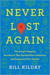
Want to find out more amazing facts about Google Earth and how it has made life better for us? Grab your copy of Never Lost Again on Book Depository and read about it!